The Category 4 hurricane made landfall Wednesday afternoon in southern Florida with 155 mph winds. Category 5 winds start at 157 mph.
People tried to raise their belongings or move them inland to avoid anticipated storm surges of 12 to 18 feet. The eye of the hurricane passed over North Captiva Island, a barrier island west of Fort Myers, at about 2:30 p.m. PowerOutage.us reported about 2.5 million power outages across the state as of Thursday morning.
As of late Wednesday, no deaths were reported in the U.S. due to Ian —but a boat of Cuban migrants did sink in the stormy waters east of Key West and the U.S. Coast Guard was searching for about 20 people in the water. Two other Cubans died earlier this week when Ian hit Cuba.
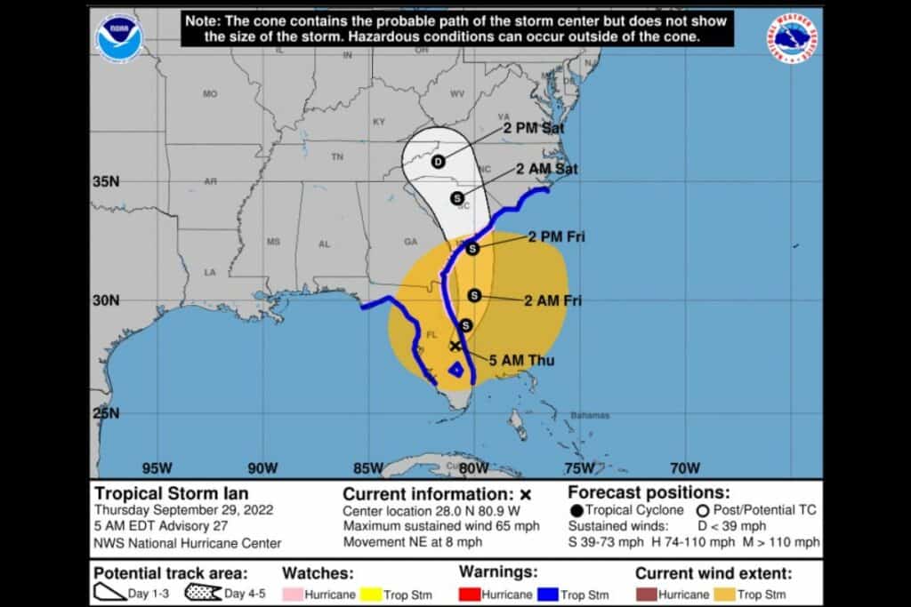
Where is the storm headed? Some models predict the storm will go from southwest Florida to the northeastern corner of the state, then curve back and continue moving north over South Carolina and parts of North Carolina. The storm would likely be downgraded to a tropical storm by the time it hits Florida’s eastern coast.
This story originally appeared in WORLD. © 2022, reprinted with permission. All rights reserved.
Suggested Articles
No related articles found.


