

Key Points
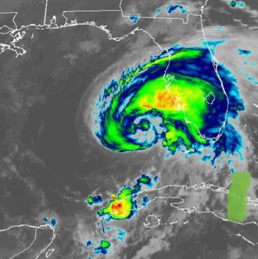
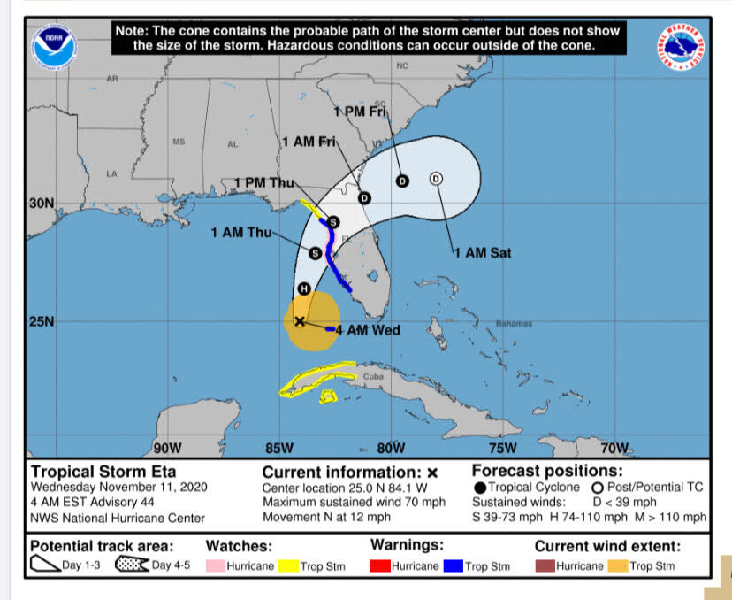
Hurricane Eta is forecast to hit Florida’s West Coast making landfall between Yankeetown and Cedar Key on Thursday at 1 p.m.
According to Assistant Director of Levy County Emergency Management David Peaton, “The earliest reasonable arrival time of the impacts of Eta could be early Wednesday (Nov. 11th) into Thursday.
Storm Surge is expected to impact Cedar Key and Yankeetown beginning for the Wednesday evening high tide cycle and continuing through Thursday, Peaton said in a report issued at 9 a.m. on Nov. 11th.
Currently, no evacuations are expected, Peaton said. But areas that are directly along the coast, campgrounds and RV parks in Cedar Key, and homes that are in danger of significant damage from strong winds or flooding, are encouraged to move to an alternate location until the event has passed.
Levy County Schools, government buildings, county parks, boat ramps, and courthouse operations will be closed on Thursday.
Peaton said storm surge of up to 7 feet along the coast. Areas that are prone to rainfall related flooding should make sure that their property is secure. The potential for strong winds with gusts as high as 60 mph are possible, so make sure that you protect your home from debris and prepare for sporadic, and in some areas, extended power outages.
Public Information lines will be open at 11 a.m. today and stay open until otherwise noted. Those phone lines are 352-486-5155 and 352-486-5576.
According to Peaton, “This storm is changing constantly.”
He urges residents to, “Make sure that you and your family are prepared for the worst. Monitor your local news/weather provider and listen to local authorities if evacuation orders are given.”
The National Weather Service announced a hurricane watch from Ana Maria Island to Yankeetown, a tropical storm warning from Bonita Beach to Suwanee River – including coastal portions of counties and Polk county and a storm surge watch for Bonita Beach to Steinhatchee River, including Tampa Bay and Charlotte Harbor.
Bands of rain will travel through North Central Florida tomorrow as Eta is expected to cross the state over Ocala and the Villages and up through Jacksonville.
Tags:none

Suggested Articles
No related articles found.
Subscribe
0 Comments
Oldest