

- Gov. Ron DeSantis declared a state of emergency for 25 Florida counties ahead of Tropical Depression Nine's potential impacts.
- The Florida Division of Emergency Management is staging generators, fuel, flood barriers, and other resources in Tallahassee and Santa Rosa.
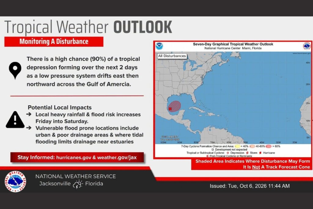
- Tropical Depression Nine has a 90% chance of forming soon and could bring heavy rain, strong winds, and flooding to the Gulf Coast this week.
Gov. Ron DeSantis has declared a state of emergency for 25 Florida counties as the state prepares for potential impacts from Tropical Depression Nine, which is expected to strengthen in the coming days.
DeSantis signed Executive Order 26-202 on Tuesday afternoon to allow the Florida Division of Emergency Management and the State Emergency Response Team (SERT) to stage resources and prepare for potential storm impacts.
The state of emergency covers Baker, Bay, Calhoun, Columbia, Dixie, Escambia, Franklin, Gadsden, Gilchrist, Gulf, Hamilton, Holmes, Jackson, Jefferson, Lafayette, Leon, Liberty, Madison, Okaloosa, Santa Rosa, Suwannee, Taylor, Walton, Wakulla and Washington counties.
“Today, I signed an Executive Order issuing a state of emergency ahead of potential impacts from Tropical Depression 9,” DeSantis said in a press release. “This order will allow the Florida Division of Emergency Management to stage critical preparedness resources and ensure Florida is ready to respond. Floridians should take this time to get disaster plans in place and ensure their hurricane supply kit is stocked.”
According to the National Oceanic and Atmospheric Administration, “Showers and thunderstorms are showing signs of organization in association with a broad area of low pressure located over the southwestern Gulf of America. Continued development of this system is expected, and a tropical depression is anticipated to form over the next day or so while it drifts eastward.
“The disturbance is expected to turn to the north or northeast toward the northern Gulf Coast by the end of the week. It is still too early to determine specific impacts to the northern Gulf Coast, but interests from the Florida Panhandle to Louisiana should closely monitor the progress of this system. The NOAA Gulfstream is scheduled to sample the environment over the Gulf later today and an Air Force reconnaissance aircraft is scheduled to investigate the system (Wednesday). It has a high (90 percent) chance of formation in 49 hours and in the next seven days.”
SERT teams are mobilizing resources to support storm preparation and response efforts. Resources will be strategically staged in Tallahassee and the Santa Rosa area for rapid deployment as needed.
Staged resources include:
- Generators
- Fuel
- Flood barriers
- Boxed water pallets
- Shelf-stable meals
- Flood buckets
- Tarps
- Tiger Dams
- Sandbags
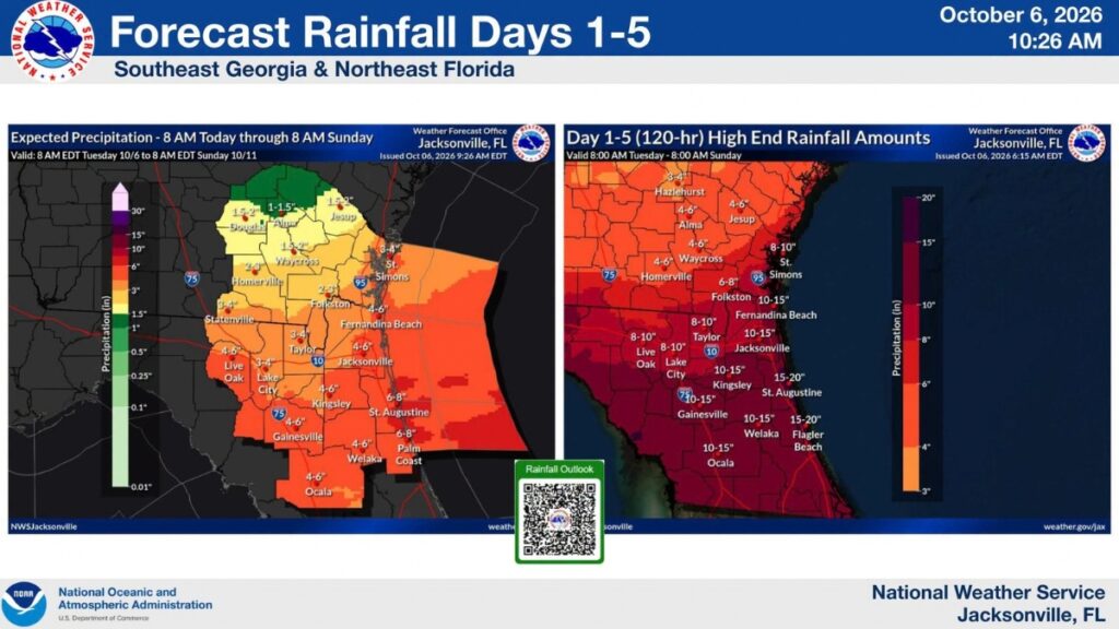
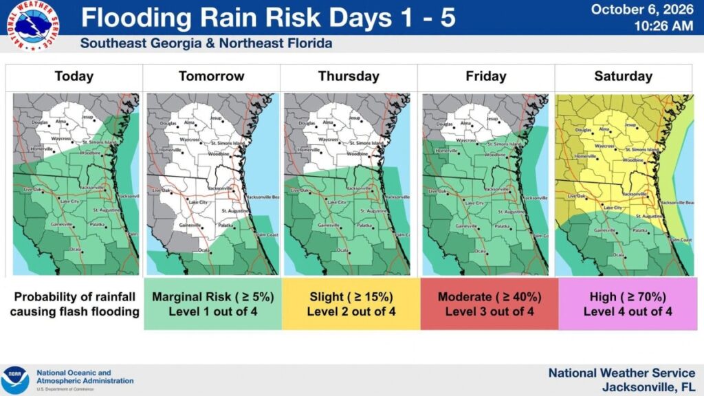
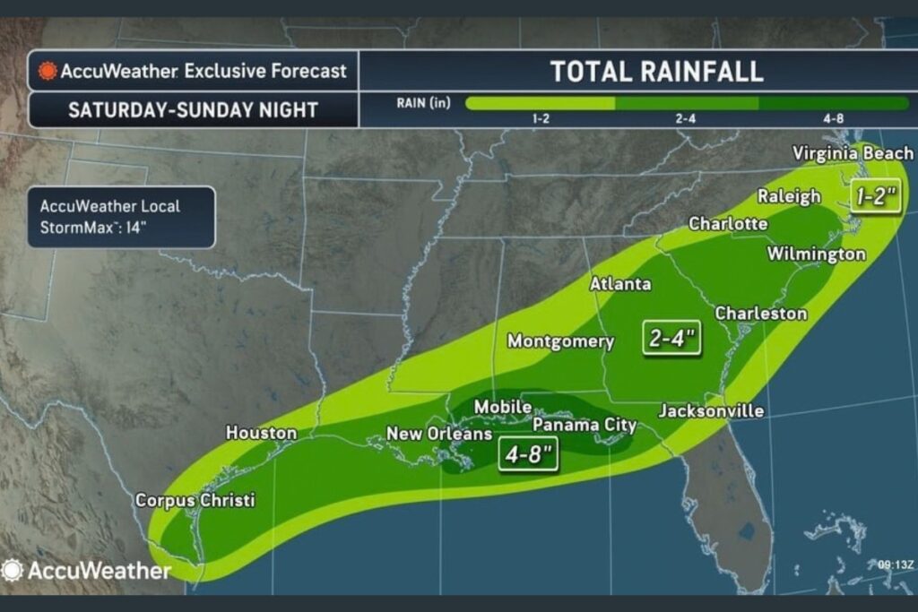
The current forecast indicates a tropical storm or hurricane could make landfall along the central Gulf Coast later this week. Potential impacts could extend beyond the point of landfall, with heavy rainfall, strong winds, coastal flooding and isolated tornadoes possible across North Florida.
Additional rainfall could further saturate soils and increase the potential for flash flooding following recent significant rainfall across the state.
Floridians are encouraged to review disaster plans and ensure hurricane supply kits are stocked before potential impacts from the storm.
For preparedness information and resources, visit FloridaDisaster.org.