

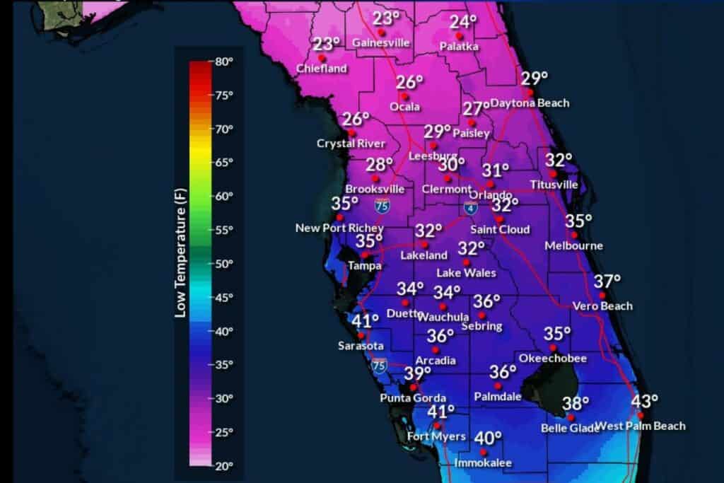
A projected cold front will move into North Central Florida Friday night with temperatures dipping into the 20s.
According to the National Weather Service (NWS) forecast, an arctic blast will hit most of the United States this weekend.
Starting Friday night, the temperature will drop to the low 20s and winds of around 10 mph will lead to a wind chill as low as 13 degrees. The lows will remain on Saturday and Sunday night in the mid to high 20s. Monday has a projected low of around 35 degrees with Tuesday night up to 33 degrees and Wednesday at 43.
The high for Saturday and Sunday will be near the low to mid-40s and Monday will increase to near 50. Tuesday will be a high near 57 and warmer weather starts returning by Wednesday with a high of 63.
The city of Gainesville activated its Cold Night Shelter (CNS) Program which provides shelter for families and individuals desiring a warm place to stay. St. Francis House (413 S. Main St.) and GRACE Marketplace (3055 NE 28th Drive) will provide CNS services to people in need of shelter if overnight temperatures remain below 45 degrees.
On Thursday, Mount Pleasant United Methodist Church gave away 40 blankets and 22 beanies to the homeless at the St. Francis House.
Plants should be covered during the cold spell and Gainesville Regional Utilities (GRU) released information on how to save energy and money while heating your home.
The cold front will hinder travel nationwide during the holiday weekend.

Suggested Articles
No related articles found.