


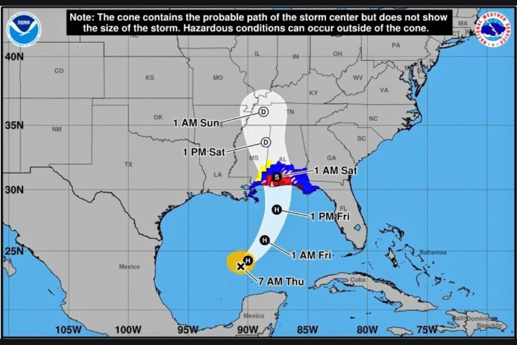
- Hurricane Isaias was upgraded to Category 1 on Wednesday night and is expected to strengthen before reaching the northern Gulf Coast on Friday.
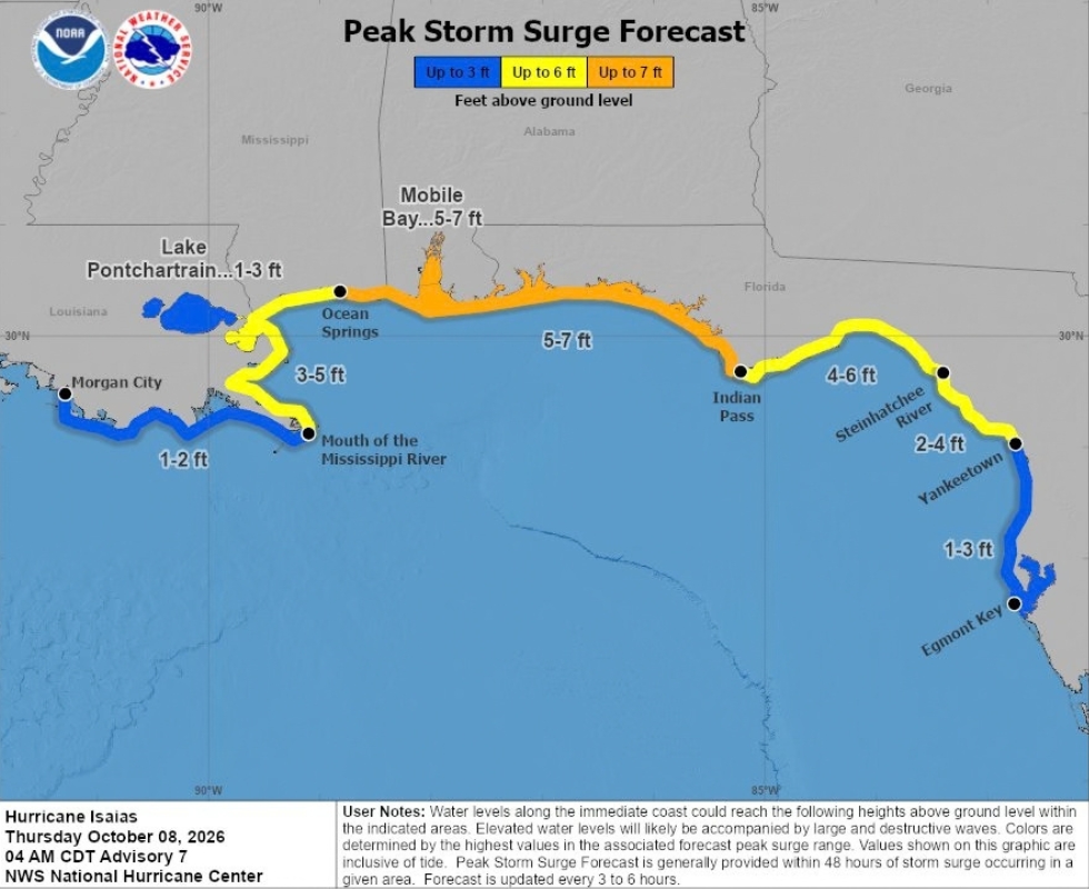
- A Storm Surge Warning is in effect from the Mississippi River mouth to the Steinhatchee River, with warnings for coastal flooding up to 6 feet.
- Isaias is forecast to bring 3 to 7 inches of rain with gusts up to 60 mph in North Florida, with low tornado and flash flooding risks.
Hurricane Isaias was upgraded to a Category 1 hurricane Wednesday night and is expected to continue strengthening as it approaches the northern Gulf Coast on Friday, bringing the potential for storm surge and heavy rainfall across portions of North Florida.
According to the National Hurricane Center (NHC), a Storm Surge Warning remains in effect from the mouth of the Mississippi River to the Steinhatchee River in Florida. A Storm Surge Watch is in effect from the Steinhatchee River to Yankeetown.
On Wednesday, Isaias strengthened from a tropical depression into a tropical storm.
On Tuesday, Florida Gov. Ron DeSantis declared a State of Emergency in 25 counties in the Panhandle and North Florida. The storm follows AccuWeather’s late-September statement that the 2026 Atlantic hurricane season might not produce a hurricane, something that hasn’t happened since 1914.
The storm has led to multiple high school football games being moved up from Friday to Thursday.
Storm surge threat
The combination of storm surge and high tide could cause normally dry coastal areas to flood as rising water moves inland from the shoreline.
Forecast peak surge heights above ground include:
- Indian Pass, Florida, to the Steinhatchee River: 4 to 6 feet
- Steinhatchee River to Yankeetown, Florida: 2 to 4 feet
Heavy rainfall and wind gusts
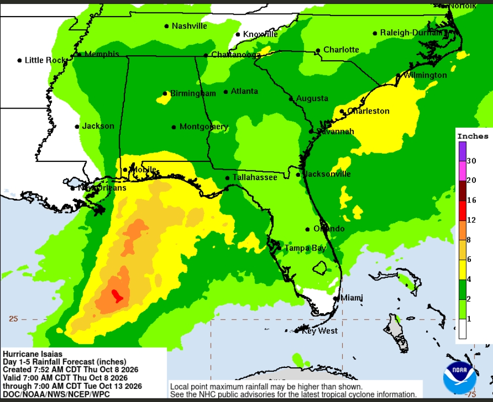
From Friday through the weekend, Isaias is expected to produce 3 to 7 inches of rain, with localized totals of up to 10 inches, across the central U.S. Gulf Coast from far southeastern Louisiana to the Florida Panhandle.
The Gainesville area is expected to see showers and thunderstorms from Friday through Sunday, with 1 to 3 inches of rain.
Wind gusts in North Florida are projected up to 60 mph and chances of tornadoes and flash flooding are considered low.