


Shutterstock
Key Points
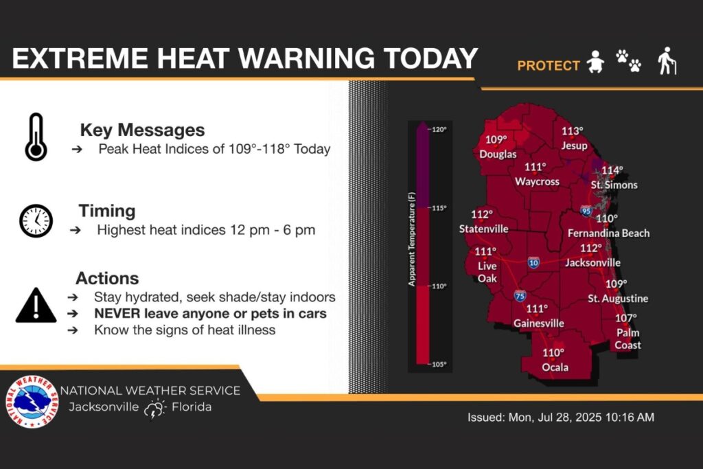
The National Weather Service (NWS) has issued an extreme heat watch, effective throughout North Florida, as the heat index is expected to rise above 110 degrees Fahrenheit on Monday and Tuesday.
According to the NWS, a heat advisory was issued from noon to 7 p.m. on Monday, with a high of 99 degrees Fahrenheit, but a heat index is projected to reach 111 degrees.
On Tuesday, the high temperature is expected to be 98 degrees, with a heat index that could reach as high as 113 between noon and 7 p.m.
Precautionary actions from NWS include:
- Drink plenty of fluids, stay in an air-conditioned room, stay out of the sun and check up on relatives and neighbors.
- Do not leave young children and pets in unattended vehicles. Car interiors will reach lethal temperatures in a matter of minutes.
- Take extra precautions when outside. Wear lightweight and loose-fitting clothing. Try to limit strenuous activities to early morning or evening. Take action when you see symptoms of heat exhaustion and heat stroke.
- To reduce risk during outdoor work, the Occupational Safety and Health Administration recommends scheduling frequent rest breaks in shaded or air-conditioned environments. Anyone overcome by heat should be moved to a cool and shaded location. Heat stroke is an emergency and call 911.


Suggested Articles
No related articles found.
Thank you for the warnings. Truly dangerous for even very fit people working/playing outdoors. Kids especially.