


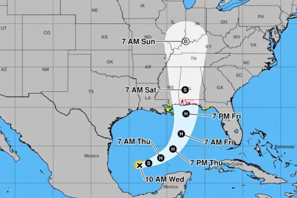
- Tropical Storm Isaias is expected to become the first hurricane of the 2026 Atlantic season by Thursday as it moves toward the U.S. Gulf Coast.
- Florida Gov. Ron DeSantis declared a State of Emergency in 25 counties due to Isaias, which may bring high winds, flooding and tornadoes.
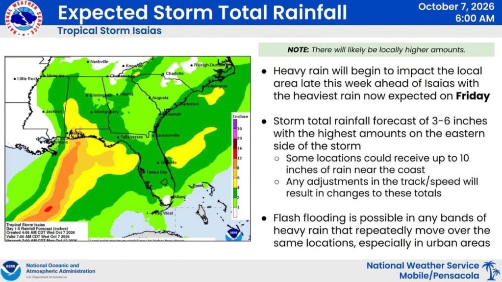
- Isaias is forecast to produce 3 to 6 inches of rain with localized totals up to 10 inches from southeastern Louisiana to the Florida Panhandle through the weekend.
Tropical Storm Isaias strengthened overnight in the Gulf of Mexico and could become the first hurricane of the 2026 Atlantic season.
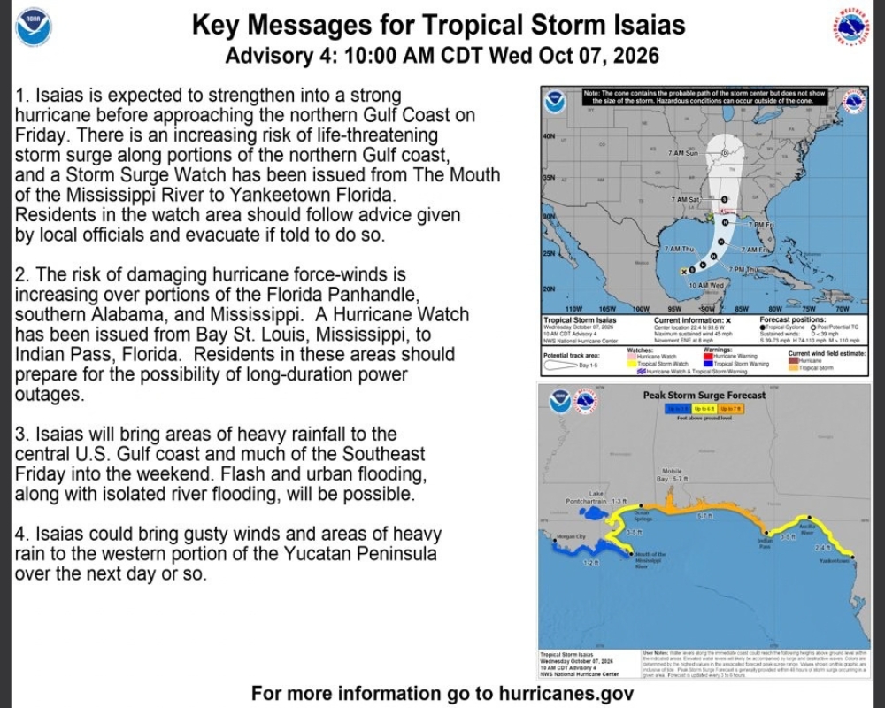
According to the National Hurricane Center (NHC), Isaias will strengthen into a hurricane by Thursday and turn north as it approaches the U.S. Gulf Coast. The forecast track has shifted slightly eastward.
On Tuesday, Florida Gov. Ron DeSantis declared a State of Emergency in 25 counties in the Panhandle and North Florida. The storm comes after AccuWeather stated at the end of September that the 2026 Atlantic hurricane season might not produce a hurricane, something that had not happened since 1914.
Concerns for North Florida include high winds, high surf, dangerous rip currents, storm surge, flash flooding and tornadoes, according to NHC.
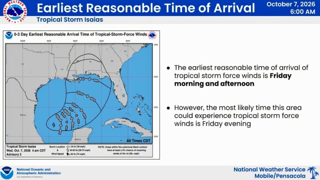
The storm is expected to continue moving east-northeast Wednesday before turning northeast and then north Thursday and Friday. The forecast track calls for Isaias to pass north of the Yucatan Peninsula Thursday and approach the northern Gulf Coast on Friday.
Maximum sustained winds have increased to about 45 mph, with higher gusts. Rapid strengthening is forecast over the next day or two, and Isaias is expected to become a hurricane by Thursday.
Rainfall and Flooding Threat
Tropical moisture interacting with a quasi-stationary boundary across Florida will continue to produce widespread thunderstorms across most of the Florida Peninsula and parts of the Panhandle and coastal southeast Georgia during the next several days, according to NHC.
Locally, heavy downpours across northern and central Florida could produce several inches of rain each day, with isolated flooding or ponding possible, particularly in urban areas.
Heavy rainfall currently just offshore in the Gulf is expected to progress northward Thursday night as Isaias turns north, increasing the threat of heavy rain reaching the Florida Panhandle by Friday morning.
From Friday through the weekend, Isaias is expected to produce 3 to 6 inches of rain, with localized totals of up to 10 inches, across portions of the central U.S. Gulf Coast from far southeastern Louisiana to the Florida Panhandle.
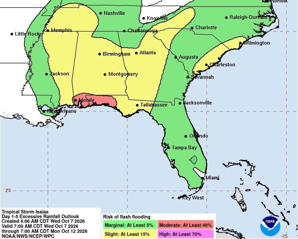
Flash and urban flooding, along with isolated river flooding, will be possible.
For additional rainfall forecasts, visit the National Hurricane Center rainfall forecast and the National Hurricane Center Flash Flood Risk graphic.