

What will future flooding be like in Cedar Key? This can be tough to visualize but technology can help. The Resilient Cedar Key team just launched a new tool, now available to all. The tool is a web-based application that allows users to explore flood vulnerability maps and data for Cedar Key and outlying areas.
The tool is designed to help residents, business owners, and local government officials understand their flood risk and make informed decisions about how to prepare for flooding. It provides a variety of features, including:
- Interactive maps that show flood risks for:
- different levels of sea level rise and
- different levels of storms or tide events,
- The ability to filter data and maps by the type of asset, and
- Data that show the percentage of assets affected by different flooding scenarios.
The tool is available for free online and is updated with new information periodically. To learn more and to access the tool, visit resilientcedarkey.web.app.
Why is this tool important?
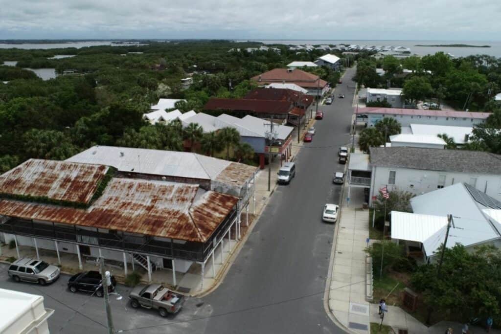
Coastal communities, including Cedar Key, are increasingly vulnerable to flooding due to climate change. The low-lying communities on Florida’s Gulf of Mexico coast are already at risk from storm surge flooding, and sea level rise only worsens flood risk over time. In fact, recent reports indicate sea levels are rising faster than projected in some areas of Florida’s Gulf Coast, including Cedar Key.
The flood mapping tool can help Cedar Key and surrounding communities understand their flood risk and make informed decisions about how to prepare for flooding. By understanding their risk, communities can take steps to mitigate their risk and protect their residents and property.
How can I use this tool?
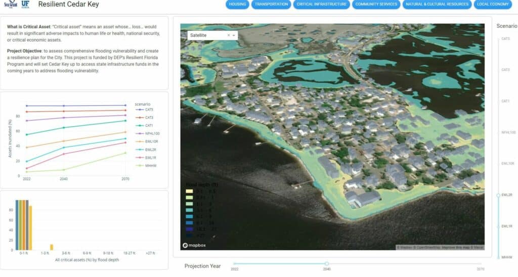
The flood mapping tool is easy to use. To get started, simply visit the website. The tool will display a map of Cedar Key with flood risk information overlaid. The default scenario is present day sea level and mean higher high water (MHHW), or the typical highest tide height.
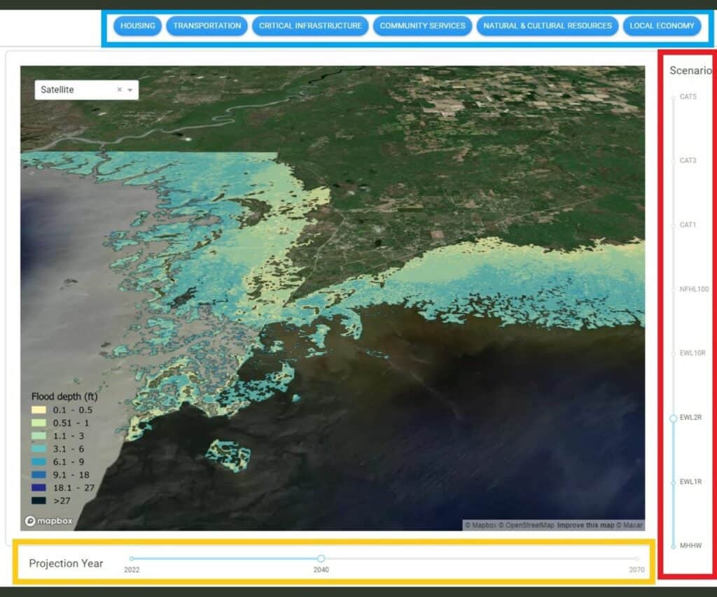
You can use the tool to explore different scenarios for sea level rise and storm events, seeing how they impact flood risk. Use the sliders along the bottom (orange box in figure below) to move between present-day, 2040, and 2070 projected sea level. Use the sliders on the right (red box in figure below) to toggle between different storm and tide scenarios. For example, you can explore flooding depths for a Category 1 hurricane at 2040 sea levels using the sliders.
To explore data by category, select one of the buttons along the top of the tool (blue box in figure below). Transportation, for example, will display more detail on road networks and other transportation-related vulnerabilities. Zoom in as far as the block scale, zoom out to a regional scale to see flooding risks off 347 and SR 24 out to Rosewood.
The flooding mapper is a valuable tool for Cedar Key. By using the tool, users can better understand their flood risk and make informed decisions about how to prepare for future flooding.
What is Resilient Cedar Key?
Resilient Cedar Key is a grant funded through the Resilient Florida program. It is a two-part project that includes:
- a comprehensive flooding vulnerability assessment (VA) and
- an adaptation and resilience plan
The Flooding VA will highlight problem areas of future risk. After completing the VA, the City will be eligible for additional funding resources from the state. The adaptation and resilience plan will outline projects that the City could undertake to address flooding risks.

Suggested Articles
No related articles found.